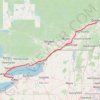
Mount Lafayette Loop via Franconia Ridge Trail in White Mountain National Forest
The Mount Lafayette Loop is a challenging and rewarding hike, offering some of the most stunning views in the region. Starting at the Falling Waters Trail, the hike begins with a steep ascent through the forest, passing several picturesque waterfalls. The real highlight, however, comes as you reach the Franconia Ridge, where the trail opens up to expansive, exposed views. From here, you’ll traverse along the ridge, passing the summits of Mount Lafayette, Mount Lincoln, and Little Haystack, all offering sweeping panoramic views of the surrounding mountains and valleys, including the Pemi Wilderness and Franconia Notch. The rocky terrain can be demanding, especially when you climb above treeline, but the scenery more than makes up for the effort. This route is not only a physical challenge but also a visual feast, ideal for experienced hikers prepared for rugged conditions. #Hiking #Loop #Mountain #Waterfall #Overlook #Forest #Nature
- Distance: 13.2 Km
- Elevation gain: 1,118 m
- Maximum elevation: 1,582 m
- Elevation loss: 1,113 m
- Minimum elevation: 547 m
- Moving time: 4 h 55 m
- Moving speed: 2.7 Km/h
- Maximum speed: 10.5 Km/h
- Total time: 5 h 2 m
- Global speed: 2.6 Km/h
Interactive trail map
Trail profile
- Distance: 13.2 Km
- Elevation gain: 1,118 m
- Maximum elevation: 1,582 m
- Elevation loss: 1,113 m
- Minimum elevation: 547 m
- Moving time: 4 h 55 m
- Moving speed: 2.7 Km/h
- Maximum speed: 10.5 Km/h
- Total time: 5 h 2 m
- Global speed: 2.6 Km/h
About this trail
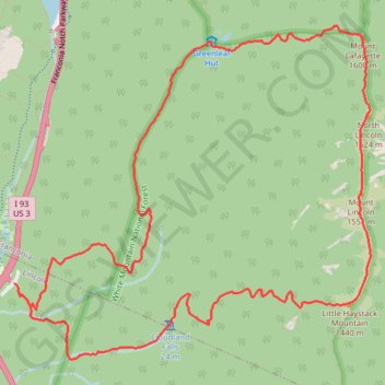
Name: Mount Lafayette Loop via Franconia Ridge Trail in White Mountain National Forest trail, distance, elevation, map, profile, GPS track
End: Trailhead Parking, Lincoln, Grafton County, New Hampshire, United States (44.14164 -71.68081)
Coordinates: 44.13624 -71.68121 44.16162 -71.64349
Other hiking, mountain biking, running and outdoor activity trails
Click on a trail to view its statistics, map and profile.
Little Haystack Mountain, Mount Lincoln and Mount Lafayette Loop
United States > New Hampshire > Grafton County > Lincoln
Loop hike from Franconia Notch via Falling Waters Trail, Stairs Falls, Swiftwater Falls, Cloudland Falls, Little Haystack Mountain, Franconia Ridge Trail, Mount Lincoln, Mount Lafayette, Greenleaf Trail, Greenleaf Hut and Old Bridle Path in the Franconia Notch State Park and the White Mountain National Forest.…
Distance: 13.1 Km • Elevation gain: 1,146 m • Maximum elevation: 1,582 m
Mount Lafayette Loop
United States > New Hampshire > Grafton County > Lincoln
The Mount Lafayette Loop begins in Franconia Notch, at the edge of the White Mountain National Forest, and climbs away from the parkway into shaded hardwood and spruce forest. The route follows the Falling Waters side of the loop beside Walker Brook and Dry Brook, passing Stairs Falls and Cloudland Falls as…
Distance: 13.5 Km • Elevation gain: 1,138 m • Maximum elevation: 1,582 m