
Salmon Pools (Sentier Trous de Saumon)
- Distance: 9.9 Km
- Elevation gain: 170 m
- Maximum elevation: 71 m
- Elevation loss: 178 m
- Minimum elevation: 15 m
- Moving time: 2 h 6 m
- Moving speed: 4.7 Km/h
- Maximum speed: 37.0 Km/h
- Total time: 2 h 21 m
- Global speed: 4.2 Km/h
Interactive trail map
Trail profile
- Distance: 9.9 Km
- Elevation gain: 170 m
- Maximum elevation: 71 m
- Elevation loss: 178 m
- Minimum elevation: 15 m
- Moving time: 2 h 6 m
- Moving speed: 4.7 Km/h
- Maximum speed: 37.0 Km/h
- Total time: 2 h 21 m
- Global speed: 4.2 Km/h
About this trail
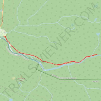
Name: Salmon Pools (Sentier Trous de Saumon) trail, distance, elevation, map, profile, GPS track
Coordinates: 46.63208 -60.94778 46.64355 -60.89389