
Dripping Springs (Grand Canyon)
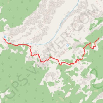
Starting at historic Hermits Rest, the route leaves the South Rim gateway to the Hermit Trail and descends from the viewpoint area onto steep canyon switchbacks through the upper limestone and sandstone layers, with widening views into the Grand Canyon.
The trail then passes through Waldron Basin and reaches the Dripping Springs Trail junction, turning away from the main Hermit Trail onto a quieter traverse beneath pale cliffs, shaded alcoves, pinyon-juniper slopes, and open views across Hermit Canyon.
The hike finishes at Dripping Springs, a perennial water source in a sheltered canyon alcove historically associated with Louis Boucher, where dripping water, desert vegetation, Supai-colored walls, and the surrounding silence give the route a secluded inner-canyon character.
#Hiking #Canyon #Mountain #Nature #Forest #Park #Springs #Desert #Viewpoint #Wilderness
- Distance: 5.2 Km
- Elevation gain: 347 m
- Maximum elevation: 2,030 m
- Elevation loss: 609 m
- Minimum elevation: 1,555 m
Interactive trail map
Trail profile
- Distance: 5.2 Km
- Elevation gain: 347 m
- Maximum elevation: 2,030 m
- Elevation loss: 609 m
- Minimum elevation: 1,555 m
About this trail
Name: Dripping Springs (Grand Canyon) trail, distance, elevation, map, profile, GPS track
Start: Hermits Rest Access, Coconino County, Arizona, United States (36.06211 -112.21124)
End: Dripping Springs Trail, Coconino County, Arizona, United States (36.06200 -112.24264)
Coordinates: 36.05487 -112.24264 36.06211 -112.21124