
Big Pine Creek Trail to First Lake and Second Lake via First Falls and Second Falls
The Big Pine Creek Trail is a rewarding hike in the Inyo National Forest, offering stunning views of cascading waterfalls, rugged mountain landscapes, and serene alpine lakes. As you ascend, the trail weaves through diverse terrain, with sections shaded by trees and others offering expansive vistas of the surrounding peaks. The route is known for its clear, turquoise lakes nestled beneath towering cliffs, making it a perfect destination for both casual hikers and those looking to continue on to higher lakes. #Hiking #Mountain #Waterfall #Forest #Nature
- Distance: 14.0 Km
- Elevation gain: 715 m
- Maximum elevation: 3,076 m
- Elevation loss: 715 m
- Minimum elevation: 2,382 m
Interactive trail map
Trail profile
- Distance: 14.0 Km
- Elevation gain: 715 m
- Maximum elevation: 3,076 m
- Elevation loss: 715 m
- Minimum elevation: 2,382 m
About this trail
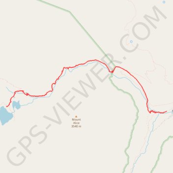
Name: Big Pine Creek Trail to First Lake and Second Lake via First Falls and Second Falls trail, distance, elevation, map, profile, GPS track
Start: Glacier Lodge Road, Inyo County, California, United States (37.12486 -118.43868)
End: Glacier Lodge Road, Inyo County, California, United States (37.12486 -118.43868)
Coordinates: 37.12441 -118.48706 37.13719 -118.43868
Other hiking, mountain biking, running and outdoor activity trails
Click on a trail to view its statistics, map and profile.

Big Pine Lakes Loop
United States > California > Inyo County
From the Glacier Lodge area, this Big Pine Lakes Loop begins along the North Fork Big Pine Creek Trail, entering the John Muir Wilderness of Inyo National Forest. The route climbs beside North Fork Big Pine Creek through forest and sagebrush slopes before reaching the higher canyon beneath Mount Alice. The…
Distance: 24.5 Km • Elevation gain: 1,235 m • Maximum elevation: 3,432 m