Thank you for supporting this site ❤️
Make a donation
Make a donation
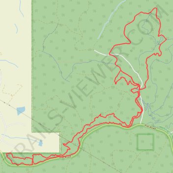
Wellington National Park MTB Ride: Boylan, Wals, Lennard Half Circuit and Grizzly loop
- Distance: 22.8 Km
- Elevation gain: 325 m
- Maximum elevation: 324 m
- Elevation loss: 325 m
- Minimum elevation: 222 m
- Moving time: 2 h 4 m
- Moving speed: 11.0 Km/h
- Maximum speed: 35.1 Km/h
- Total time: 2 h 32 m
- Global speed: 9.0 Km/h
Interactive trail map
Thank you for supporting this site ❤️
Make a donation
Make a donation
Trail profile
- Distance: 22.8 Km
- Elevation gain: 325 m
- Maximum elevation: 324 m
- Elevation loss: 325 m
- Minimum elevation: 222 m
- Moving time: 2 h 4 m
- Moving speed: 11.0 Km/h
- Maximum speed: 35.1 Km/h
- Total time: 2 h 32 m
- Global speed: 9.0 Km/h
Thank you for supporting this site ❤️
Make a donation
Make a donation
About this trail
Name: Wellington National Park MTB Ride: Boylan, Wals, Lennard Half Circuit and Grizzly loop trail, distance, elevation, map, profile, GPS track
Start: Boylan, Wellington Forest, Western Australia, 6236, Australia (-33.40521 115.86100)
End: Boylan, Wellington Forest, Western Australia, 6236, Australia (-33.40519 115.86111)
Coordinates: -33.40802 115.86100 -33.37026 115.90687
Thank you for supporting this site ❤️
Make a donation
Make a donation