
Slickrock trails
Click on a trail to view its statistics, map and profile.
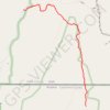
The Wave
United States > Utah > Kane County
From Wire Pass Trailhead, the route leaves House Rock Valley Road and follows the open desert toward Wire Pass, crossing sandy washes and sparse high-desert flats before entering the remote backcountry of Coyote Buttes North, a permit-only section of the Paria Canyon–Vermilion Cliffs Wilderness known for its…
Distance: 4.5 Km • Elevation gain: 213 m • Maximum elevation: 1,595 m
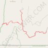
Buckskin Gulch
United States > Utah > Kane County
From Wire Pass Trailhead, the hike follows the sandy course of Coyote Wash along the Wire Pass Trail, crossing open desert before the wash tightens into Wire Pass Slot Canyon. Smooth sandstone walls, shaded narrows, and a nearby petroglyph panel lead toward the junction with Buckskin Gulch. At this junction,…
Distance: 16.7 Km • Elevation gain: 381 m • Maximum elevation: 1,486 m
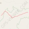
Indian Maiden Falls
United States > Arizona > Yavapai County
Beginning on the quiet uplands near Bald Hill, this route follows the upper West Clear Creek Trail across pinyon-juniper country toward the canyon rim before committing to the steep, loose descent through exposed slopes and a side drainage, with broad views into the deep gorge cut from the southern edge of the…
Distance: 6.5 Km • Elevation gain: 133 m • Maximum elevation: 1,762 m
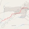
Delicate Arch
United States > Utah > Grand County
Starting at the Delicate Arch Trailhead, the route leaves the parking area near Salt Wash and follows Delicate Arch Trail past the historic Wolfe Ranch area and the nearby Ute Indian petroglyph panel. From there, it heads into open desert terrain, crossing shallow drainages and moving away from the easier…
Distance: 5.1 Km • Elevation gain: 194 m • Maximum elevation: 1,469 m
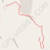
Fire Wave (Valley of Fire State Park)
United States > Nevada > Clark County
From the Fire Wave parking area on White Domes Road, the route follows the Fire Wave Trail across open desert terrain, where pale sand, low shrubs, and warm-toned sandstone already introduce the distinctive scenery of Valley of Fire State Park. As the trail continues farther from the road, it crosses sandy and…
Distance: 1.4 Km • Elevation gain: 30 m • Maximum elevation: 621 m
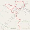
Dry Fork Narrows, Peek-A-Boo and Spooky Slot Canyons Loop
United States > Utah > Kane County
From the Dry Fork trailhead near Hole-in-the-Rock Road, the route crosses open slickrock and sandy desert benches before dropping into Dry Fork of Coyote Gulch, where the broad wash leads toward the smooth, shadowed corridors of Dry Fork Narrows. This Scorpion Wilderness Study Area hike sits within Grand…
Distance: 9.7 Km • Elevation gain: 222 m • Maximum elevation: 1,517 m
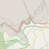
Zion Canyon Overlook
United States > Utah > Washington County
Starting near the Zion–Mount Carmel Tunnel, the Canyon Overlook Trail climbs sandstone steps and follows rocky ledges above Pine Creek’s shadowed slot canyon. The route then winds through pale slickrock, canyon walls, desert shrubs, and sheltered alcoves, with chances to spot bighorn sheep along the way.…
Distance: 0.8 Km • Elevation gain: 67 m • Maximum elevation: 1,619 m
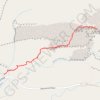
Delicate Arch Trail in Arches National Park
United States > Utah > Grand County
Hiking the Delicate Arch Trail is an unforgettable adventure that takes you through the striking red rock landscape of Arches National Park. The path leads you closer to one of the most recognizable natural arches in the world, and while the final approach can be a bit intimidating with its open slickrock, the…
Distance: 5.2 Km • Elevation gain: 209 m • Maximum elevation: 1,469 m
Delicate Arch Trail in Arches National Park
United States > Utah > Grand County
The Delicate Arch Trail offers a rewarding experience, combining a moderately challenging hike with breathtaking scenery. The trail takes you through varied terrain, including stretches of slickrock and a narrow sandstone ridge, leading to the iconic arch perched dramatically above a natural rock bowl. Along…
Distance: 5.0 Km • Elevation gain: 177 m • Maximum elevation: 1,469 m
Corona Arch Trail
United States > Utah > Grand County
The Corona Arch Trail near Moab offers a captivating journey through the rugged desert landscape. Hikers pass by two other notable arches, Pinto Arch and Bowtie Arch, before reaching the grand Corona Arch. Along the way, sections of slickrock, metal cables, and even a small ladder add a bit of adventure,…
Distance: 4.2 Km • Elevation gain: 227 m • Maximum elevation: 1,357 m